


Tholonet

jcm17
User

Length
9.1 km

Max alt
354 m

Uphill gradient
297 m
Km-Effort
13.1 km

Min alt
179 m

Downhill gradient
298 m
Boucle
Yes
Creation date :
2024-10-02 07:17:35.546
Updated on :
2025-02-17 09:10:53.433
2h58
Difficulty : Difficult

FREE GPS app for hiking
 SityTrail
IGN / Geographical institutes
SityTrail Plus
The world is yours!
About
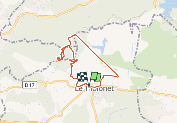
Trail Walking of 9.1 km to be discovered at Provence-Alpes-Côte d'Azur, Bouches-du-Rhône, Le Tholonet. This trail is proposed by jcm17.

Positioning
Country:
France
Region :
Provence-Alpes-Côte d'Azur
Department/Province :
Bouches-du-Rhône
Municipality :
Le Tholonet
Location:
Unknown
Start:(Dec)
Start:(UTM)
702879 ; 4821823 (31T) N.
Comments